
Alwen Reservoir, near Denbigh
Walk or cycle around this huge upland reservoir

Coed Llangwyfan woodland clings onto a steep-sided hill that opens out to heather covered slopes.
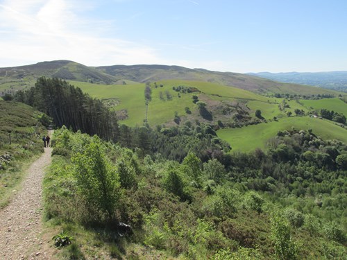
The car park is the gateway to two impressive hillforts – Penycloddiau and Moel Arthur.
There are public footpaths to both hillforts and the views from the top on a clear day are hard to beat.
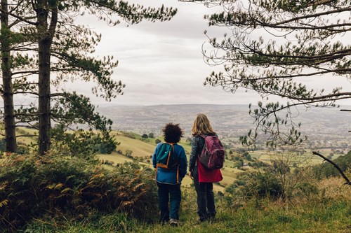
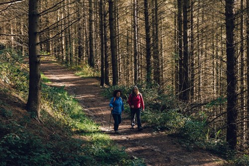
The circular waymarked walking trail follows a sheltered level path from the car park through the woodland to a viewpoint.
The walking trail is waymarked and starts from the Coed Llangwyfan car park.
Gradually drop down on a hillside path through huge conifer trees with filtered views across the valley.
Enjoy the viewpoint at the halfway point with wide views across the Vale of Clwyd.
Return on a lower level path through broadleaved woodland back up to the car park.
There are several public footpaths from the Coed Llangwyfan car park.
See the information panel in the car park for details of these two suggested routes:
These routes may not be waymarked and we recommend that you take a map with you.
The Offa’s Dyke Path National Trail goes through Coed Llangwyfan and over the summit of Penycloddiau - look out for the distinctive acorn waymarker posts.
Find out more about National Trails in Wales.
Coed Llangwyfan is situated in the Clwydian Range and Dee Valley Area of Outstanding Natural Beauty (AONB).
The Clywdian Range is a chain of purple heather-clad summits topped by hillforts. The Dee Valley lies beyond these windswept hills and is home to the historic towns of Llangollen and Corwen.
For more information about visiting the AONB go to the Clwydian Range and Dee Valley website.
Coed Llangwyfan forms part of the National Forest for Wales.
The National Forest will:
It will form a connected ecological network running throughout Wales, bringing social, economic and environmental benefits.
Parts of the network will eventually form a trail running the length and breadth of Wales, so anyone can access it wherever they live.
For more information go to the National Forest for Wales website.
We want you to return home safely after your visit here.
You are responsible for your own safety as well as the safety of any children and animals with you during your visit.
For advice and tips to help you plan your visit here go to Visiting our places safely.
See the top of this webpage for details of any planned closures or other changes to visitor facilities here.
For your safety, always follow instructions from staff and signs including those for trail diversions or closures.
We may divert or close trails whilst we undertake maintenance work or other operations and we may need to close other visitor facilities temporarily.
In extreme weather, we may close facilities at short notice due to the risk of injury to visitors and staff.
You may need permission from us to organise an event or to carry out some activities on our land.
Check if you are allowed to use our land.
Coed Llangwyfan is 5 miles east of Denbigh.
The postcode is CH7 5RP.
Please note that this postcode may not take you to the car park if you use a sat nav or navigation app.
We suggest you follow the directions below or use the Google map on this page which has a pin on the car park’s location.
From the A525 south of Denbigh, take the minor road signposted to Llanddyrnog from the roundabout.
Go straight on at the next roundabout.
Take the next left and the main Coed Llangwyfan car park is on the left at the top of the hill, after passing a small lay-by.
View this place on the What3Words website.
The Ordnance Survey (OS) grid reference for the car park is SJ 138 668 (Explorer Map 265).
The nearest mainline railway station is in Buckley.
For details of public transport go to the Traveline Cymru website.
Parking is free of charge.
Overnight parking is not permitted.
There are no staff at this location.
Contact our customer team for general enquiries during office hours, Monday to Friday.


