
The Arch, near Aberystwyth
Walks through huge beech trees with views over...

Cors Caron National Nature Reserve is a vast area of wetland filling the broad valley of the River Teifi near Tregaron.
The three raised peat bogs are surrounded by reedbeds, fen, wet grassland, woodland, waterways and ponds, and these varied habitats support a wealth of wildlife.
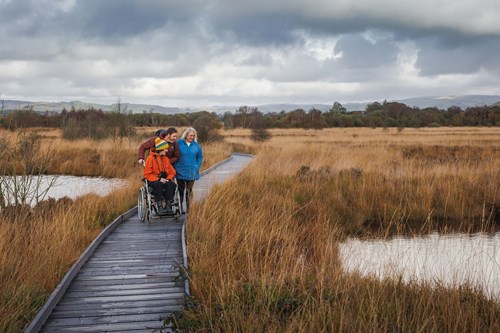
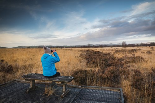
The fully accessible boardwalk goes over the south-east bog and to the large bog hide where you can enjoy a peaceful view of the landscape and wildlife.
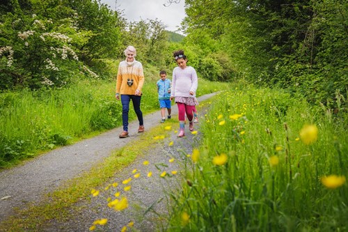
There is also a "there and back" route on an old railway track along the edge of the reserve to Ystrad Meurig which may be used by walkers, cyclists and horse riders.

The walking trails are waymarked from start to finish.
Look out for the information panel at the start of the trail.
Find out about walking trail grades.
The boardwalk goes over some of the most impressive parts of the bog to a large hide with views of the landscape.
This linear route follows an old railway track along the edge of the reserve to The Old Station Yard at Ystrad Meurig and gives good views over much of Cors Caron.
Cors Caron is a National Nature Reserve.
National Nature Reserves are places with some of the very finest examples of wildlife habitats and geological features.
The landscape and wildlife varies depending on which time of year you visit.
This large reserve covers an area of over 800ha (or three square miles).
The three raised bogs are world famous – areas of deep peat that have built up over the last 12,000 years. They are some of the most intact examples of raised peat bogs in Britain, with millions of cubic metres of peat up to ten metres deep.
The River Teifi and its floodplain form the centre of the reserve and is internationally important in its own right as a European Special Area of Conservation (SAC); the extensive floodplain feels wild and remote.
The route of the old Aberystwyth to Carmarthen railway running along the margin of Cors Caron has developed a wide range of habitats since the railway’s closure in the 1960s.
This rich mix of habitats makes the reserve a fantastic place for wildlife. Red kite, hen harrier, curlew and skylark can fill the skies above the reserve, whilst the bog itself bustles with dragonflies, lizards and otters.
There are over 70 National Nature Reserves in Wales.
Find out more about National Nature Reserves
Cors Caron National Nature Reserve is one of seven places in the Welsh Raised Bogs Project.
This project is the first national restoration programme for raised bogs in Wales.
Cors Caron is one of the largest actively growing raised bogs in the lowlands of Britain and has peat up to 10 metres deep.
Raised bogs are one of Wales’ rarest and most important habitats and are home to rare plants and wildlife.
Raised bogs get their name because of their domed shape. They are areas of peat that have built up over 12,000 years and can be as deep as 12 metres.
To learn more about the restoration work, sign up for e-newsletters and read news releases go to the Raised Bogs project webpage
We want you to return home safely after your visit here.
You are responsible for your own safety as well as the safety of any children and animals with you during your visit.
Please note:
For advice and tips to help you plan your visit here go to Visiting our places safely.
Facilities for visitors with disabilities at Cors Caron include:
Please check the top of this webpage for any changes to these opening times.
The toilets are open at all times.
See the top of this webpage for details of any planned closures or other changes to visitor facilities here.
For your safety, always follow instructions from staff and signs including those for trail diversions or closures.
We may divert or close trails whilst we undertake maintenance work or other operations and we may need to close other visitor facilities temporarily.
In extreme weather, we may close facilities at short notice due to the risk of injury to visitors and staff.
You may need permission from us to organise an event or to carry out some activities on our land.
Check if you are allowed to use our land.
Cors Caron National Nature Reserve is 2 miles north of Tregaron.
The postcode is SY25 6JF.
Please note that this postcode may not take you to the car park if you use a sat nav or navigation app.
We suggest you follow the directions below or use the Google map on this page which has a pin on the car park’s location.
Follow the brown and white sign from the crossroads in Tregaron onto the B4343 towards Pontrhydfendigaid.
After 2 miles, the main car park is on the left.
View this place on the What3Words website.
The Ordnance Survey (OS) grid reference for the main car park is SN 692 625 (Explorer Map 187 or 199).
The nearest mainline railway station is in Aberystwyth.
Some buses between Aberystwyth and Lampeter stop in Tregaron, and the service from Aberystwyth to Tregaron via Pontrhydfendigaid goes past Cors Caron.
For details of public transport go to the Traveline Cymru website.
Sustrans National Cycle Route 82 goes to Cors Caron.
For more information see the Sustrans website.
The main car park is two miles from Tregaron on the B4343 towards Pontrhydfendigaid.
There is also a small amount of car parking in a lay-by off the B4343 north of Maesllyn Farm (OS grid reference SN 695 631) and at Ystrad Meurig Station Yard, off the B4340 (OS grid reference SN 711 673).
Parking is free of charge.
Overnight parking is not permitted.
There are no staff at this location.
Contact our customer team for general enquiries during office hours, Monday to Friday.


