
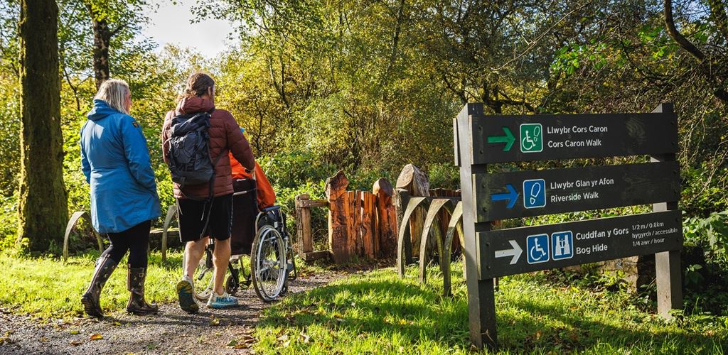
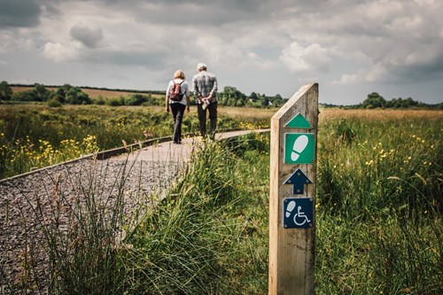
Trails for users of adaptive equipment
Watch our films to decide if a trail is suitable for your adaptive equipment
There are walking trails suitable for all abilities in our woodlands and National Nature Reserves all over Wales.
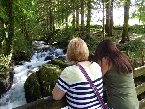
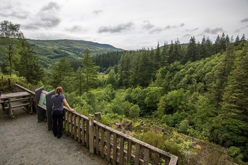
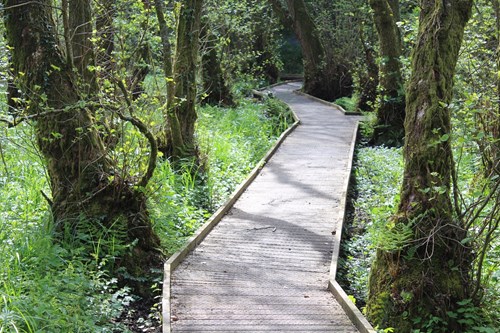
Some trails have sections of boardwalk which allow you to experience different landscapes from bogs to wetlands. Other trails follow level paths around lakes or alongside rivers and some take you to viewing areas over waterfalls.
All of our trails are waymarked from start to finish and there is an information panel at the start of each one.
Every walking trail in our woodlands and National Nature Reserves is graded to give an indication of its difficulty.
The grades take account of the trail surface, gradients and the level of fitness needed.
Trail grades are given on this website and on the information panel at the start of the trail.
Find out more about walking trail grades.
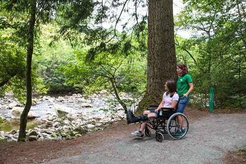
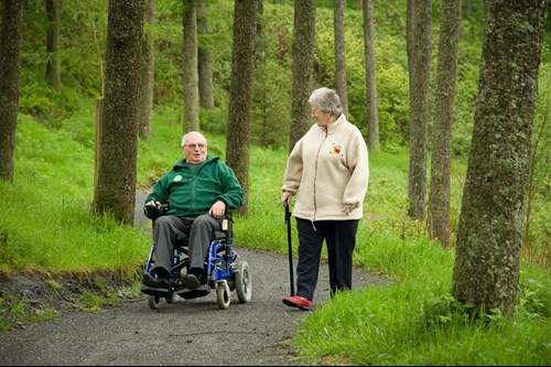
Our accessible-graded walks are suitable for everyone, including people who use a wheelchair.
Please note that assistance may be needed to push wheelchairs on some sections.
All of the walking trails on this page have been graded as accessible.
Some of the other trails in our woodlands and reserves may be suitable for users of adaptive equipment.
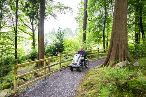
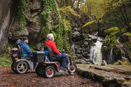
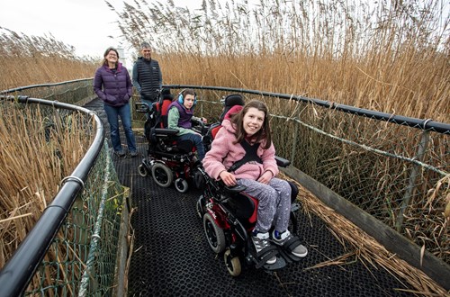
We have produced a series of films to help people who use adaptive equipment (adaptive cycles, adaptive wheelchairs and mobility scooters) work out how suitable some of our other trails may be before they visit.
To watch the films about some of our other trails go to Trails for users of adaptive equipment.
To find walking trails in our other woodlands and reserves go to Places to Visit.
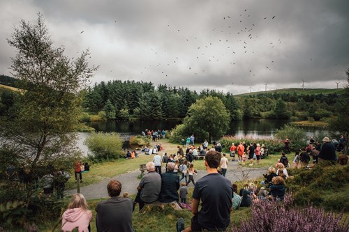
Barcud coch means red kite in Welsh and you will get the best view of the daily red kite feeding spectacle along this trail, either from inside the hide or at the viewpoint. There are posts along the trail with fascinating facts about the red kite and there is information in the hide about wildlife on the lake.
Look out for sculptures and poetry along the path which bring local folklore and history to life – pick up an Elenydd Trail leaflet in the visitor centre.
The Animal Puzzle Trail follows the same route as the Barcud Trail - pick up an Animal Puzzle Trail leaflet from the dispenser or in the visitor centre and see how many animals you can find.
Find out more about visiting Bwlch Nant yr Arian Visitor Centre
Look out for birds such as the dipper and grey wagtail, which breed on the lakeshore, and the fish ladder near the footbridge that helps salmon to reach the streams.
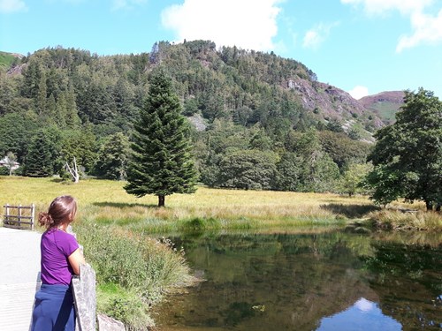
Find out more about visiting Cadair Idris National Nature Reserve
This short trail goes through the woodland and alongside a stream.
Find out more about visiting Coed Moel Famau
Follow the accessible trail down through woodlands to the riverside picnic site where the Afon Eden river rushes over the rocks.
Pick up an Animal Puzzle Trail leaflet from the visitor centre and let younger visitors follow the clues.
We have produced a film to help you work out how suitable this trail is for you before you visit.
The film is narrated by a disabled person as they negotiate the route using their own equipment. It shows the trail surface, uphill and downhill gradients and elevation and where you may need help on certain sections.
Find out more about visiting Coed y Brenin visitor centre
The trail crosses over the bridge and through the lower part of the forest garden on its way to a viewpoint overlooking the waterfall.
The forest garden is home to trees from all over the world - look out for the special signs with fascinating facts about some of the trees.
Find out more about visiting Coed y Brenin Forest Park - Forest Garden
Follow the waymarkers from the Pont Llam yr Ewig car park along an old tramway to the viewpoint above the mine workings.
Find out more about visiting Coed y Brenin Forest Park - Glasdir
See the magnificent Douglas firs, which are the biggest trees in Coed y Brenin.
The trail goes alongside the river to the tree with the widest trunk known as the King.
Find out more about visiting Coed y Brenin Forest Park - Pont Ty'n-y-groes
The multi-stemmed alders are evidence of coppicing (cutting to near the base and re-sprouting).
In spring, look out for showy marsh marigolds and the delicate pink umbrellas of valerian growing along boardwalk, and smell the fragrant bluebells growing along the path section.
Find out more about visiting Coed y Cerrig National Nature Reserve
Enjoy the sight and sound of wetland birds in the reed bed.
There's always something to see or hear, no matter what time of year.
Find out more about visiting Cors Bodeilio National Nature Reserve
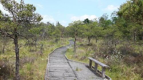
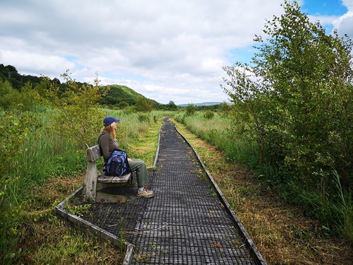
The boardwalk takes you right out into this vast area of impressive wetland.
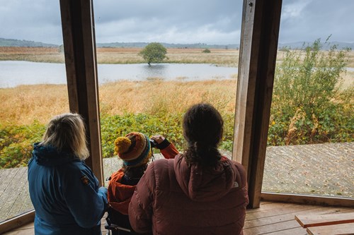
The trail goes past the large hide from where you can enjoy a peaceful (and weather-proof!) view of the landscape and wildlife.
Find out more about visiting Cors Caron National Nature Reserve
Visit in spring or summer and enjoy one of the best wildflower-rich meadows in Mid Wales at the reserve’s entrance.
The boardwalk then winds through the swampy woodland and past the forest of stunted trees.
Find out more about visiting Cors y Llyn National Nature Reserve
Dinas Rock, near Neath
On its way to the viewpoint over the Sychryd cascades the trail passes a huge rock known as Bwa Maen - look out for the information panel about this impressive geological feature.
Find out more about visiting Dinas Rock
This trail winds its way through a variety of trees, from tall conifers to young birch, and goes to an open grassy area next to the bubbling river.
Pause for a moment to listen and watch for wildlife, or find the ‘disappearing signs’ along the trail which have some fascinating facts about the trees and wildlife that live here.
Find out more visiting Llyn Crafnant
The Cascades Walk follows a boardwalk along the riverbank and onto the tumbling cascades.
Here there is a raised platform to enjoy the view before returning through the forest to the car park.
Find out more about visiting Hafren Forest
Follow the trail across the picnic site to the viewpoint over the hidden forest lake.
There you'll find information on the birds which live here, or stop at one of the picnic tables and you may be lucky enough to spot a red squirrel in the trees.
Find out more about visiting Newborough National Nature Reserve and Forest
All of the paths around the reedbeds are accessible to wheelchairs and there are benches approximately every 200 metres. The paths are level with some gentle slopes and a zig-zag ramp to climb the five metres up to the raised reedbed levels.
Look out for orchids in late spring and early summer.
Go through reedbeds, over the floating bridge and past the lighthouse.
Go through reedbeds, woodland, past open water and the estuary.
This route combines the orchid trail, the woodland and estuary trail and part of the Wales Coast Path.
Find out more about visiting Newport Wetlands National Nature Reserve
Follow the boardwalk into the heart of the fen and experience the reed and sedge beds which are home to a range of wetland plants, birds and insects.
Find out more about visiting Pant y Sais National Nature Reserve

